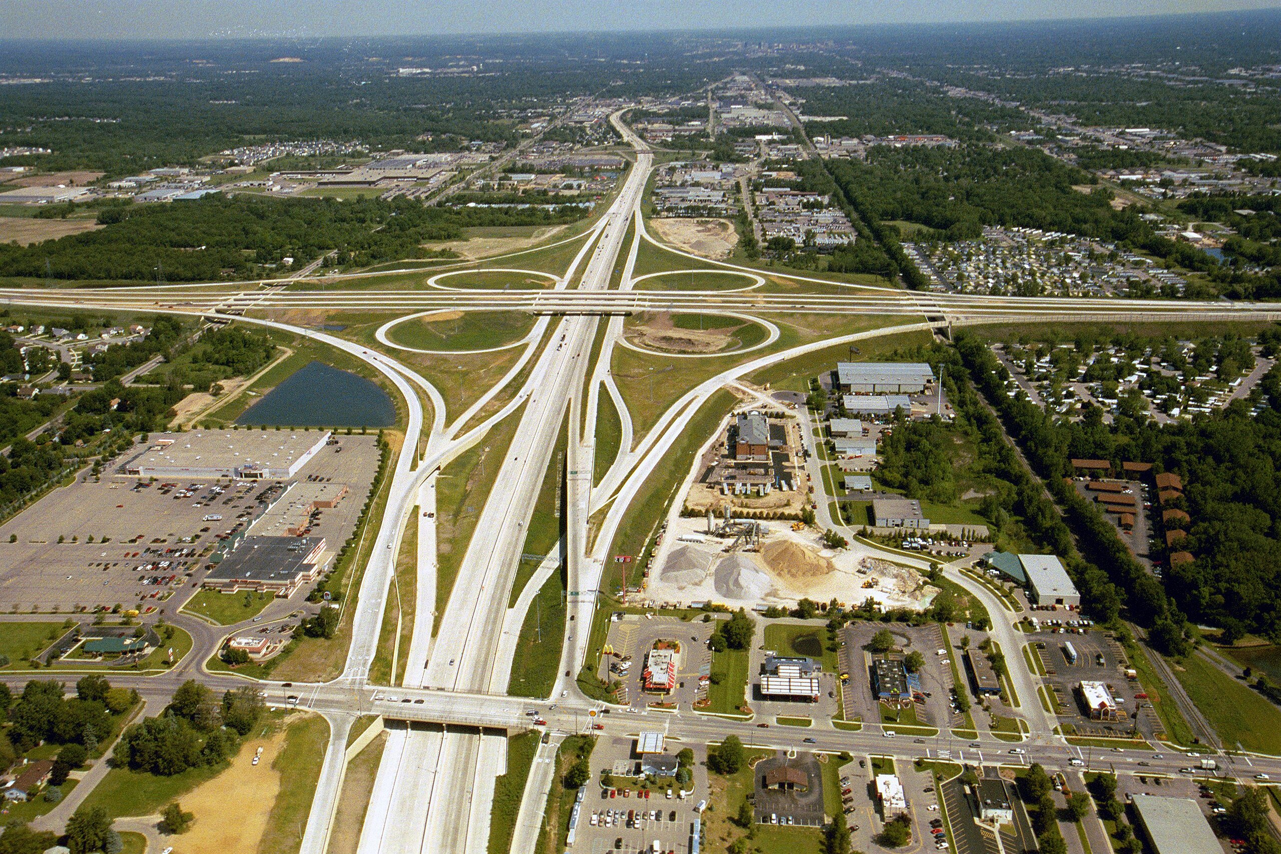
ၾၢႆႇ:US 131, M-6, 68th St interchange.jpg

သႅၼ်းတႃႇတူၺ်းလူင်ႈၼႃႈ: 800 × 533 ၽိၵ်ႉသႄႇလ်. resolutionsတၢင်ႇဢၼ် : 320 × 213 ၽိၵ်ႉသႄႇလ် | 640 × 427 ၽိၵ်ႉသႄႇလ် | 1,024 × 683 ၽိၵ်ႉသႄႇလ် | 1,280 × 853 ၽိၵ်ႉသႄႇလ် | 2,560 × 1,707 ၽိၵ်ႉသႄႇလ် | 3,072 × 2,048 ၽိၵ်ႉသႄႇလ် ။
ၾၢႆႇငဝ်ႈတိုၼ်း (3,072 × 2,048 pixels, တၢင်းလဵၵ်ႉတၢင်းယႂ်ႇ ၾၢႆႇ: 1.88 MB, ယိူင်ႈ MIME: image/jpeg)
ႁူဝ်ႁုပ်ႈ
| ၶေႃႈသပ်းလႅင်း | |
| ဝၼ်းထီႉ | |
| ငိူၼ်ႈငဝ်ႈတိုၼ်း | Michigan Department of Transportation |
| ၽူႈတႅမ်ႈလိၵ်ႈ | Michigan Department of Transportation |
| ၶေႃႈလူတ်းပွႆႇ (ၶိုၼ်းၸႂ်ႉ ၾၢႆႇဢၼ်ၼႆႉ) |
| Camera location | | View this and other nearby images on: OpenStreetMap |
|---|
| Object location | | View this and other nearby images on: OpenStreetMap |
|---|
ဝ်ႂ
| This work has been released into the public domain by its author, Michigan Department of Transportation. This applies worldwide. In some countries this may not be legally possible; if so: Michigan Department of Transportation grants anyone the right to use this work for any purpose, without any conditions, unless such conditions are required by law.
|
ပိုၼ်းၾၢႆႇ
တဵၵ်းၼိူဝ် ဝၼ်းထိ/ၶၢဝ်းယၢမ်း တႃႇႁၼ်ၾၢႆႇ ၼႂ်းဝၼ်းၼၼ်ႉ
| ဝၼ်းထီႉ/ၶၢဝ်းယၢမ်း | ႁၢင်ႈလဵၵ်ႉ | သႅၼ်းမၼ်း | ၽူႈၸႂ်ႉတိုဝ်း | တၢင်းႁၼ်ထိုင် | |
|---|---|---|---|---|---|
| ယၢမ်းလဵဝ် | 05:01, 15 တီႇသႅမ်ႇပႃႇ 2010 | | 3,072 × 2,048 (1.88 MB) | Imzadi1979 | {{Information |Description=Aerial photo of the US 131/M-6/68th St. interchange in Wyoming, MIchigan |Source=w:Michigan Department of Transportation |Date=June 2004 |Author= |
လွင်ႈၸႂ်ႉတိုဝ်း ၾၢႆႇ
ၼႃႈလိၵ်ႈ ၵွင်ႉမႃးၸူးၾၢႆႇၼႆႉ:
လွင်ႈၸႂ်ႉတိုဝ်းၾၢႆႇလူမ်ႈၽႃႉ
Wikis ၸိူဝ်းဢၼ်ၸႂ်ႉဝႆႉ ၾၢႆႇဢၼ်ၼႆႉ:
- ၸႂ်ႉဝႆႉ bn.wikipedia.org
- ၸႂ်ႉဝႆႉ en.wikipedia.org
- ၸႂ်ႉဝႆႉ en.wikiquote.org
- ၸႂ်ႉဝႆႉ en.wiktionary.org
- ၸႂ်ႉဝႆႉ eo.wiktionary.org
- ၸႂ်ႉဝႆႉ hi.wikipedia.org
- ၸႂ်ႉဝႆႉ io.wikipedia.org
- ၸႂ်ႉဝႆႉ ja.wikipedia.org
- ၸႂ်ႉဝႆႉ mk.wikipedia.org
- ၸႂ်ႉဝႆႉ ms.wikipedia.org
- ၸႂ်ႉဝႆႉ new.wikipedia.org
- ၸႂ်ႉဝႆႉ pl.wikipedia.org
- ၸႂ်ႉဝႆႉ pt.wikipedia.org
- ၸႂ်ႉဝႆႉ sr.wikipedia.org
- ၸႂ်ႉဝႆႉ sw.wikipedia.org
- ၸႂ်ႉဝႆႉ ta.wikipedia.org
- ၸႂ်ႉဝႆႉ th.wikipedia.org
- ၸႂ်ႉဝႆႉ th.wiktionary.org
- ၸႂ်ႉဝႆႉ tl.wikipedia.org
- ၸႂ်ႉဝႆႉ uk.wikipedia.org